File:CROPPED.jpg
Jump to navigation
Jump to search
No higher resolution available.
CROPPED.jpg (656 × 448 pixels, file size: 99 KB, MIME type: image/jpeg)
Summary
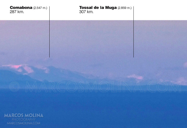
Mollorca to Pyranees 302 KM from 1002 meter elevation - globe model predicts Tossal de la Muga is 100 meters under the horizon
File history
Click on a date/time to view the file as it appeared at that time.
| Date/Time | Thumbnail | Dimensions | User | Comment | |
|---|---|---|---|---|---|
| current | 03:52, 18 April 2020 | | 656 × 448 (99 KB) | Indio007 (talk | contribs) | Mollorca to Pyranees 302 KM from 1002 meter elevation - globe model predicts Tossal de la Muga is 100 meters under the horizon |
You cannot overwrite this file.
File usage
The following page uses this file:

