Difference between revisions of "Charra SA to Lounds Island"
Jump to navigation
Jump to search
(Created page with "Lounds Island from 29.6 KM and 7.5 height - Globe model predicts the bottom of Lounds Island is 30 meters underneath the horizon <Youtube>https://www.youtube.com/watch?v=IliP9...") |
|||
| Line 1: | Line 1: | ||
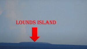
| − | Lounds Island from 29.6 KM and 7.5 height - Globe model predicts the bottom of Lounds Island is 30 meters underneath the horizon | + | [[File:Lounds Island.jpg|thumb|right||Lounds Island from 29.6 KM and 7.5 height - Globe model predicts the bottom of Lounds Island is 30 meters underneath the horizon.]] |
| + | |||
| + | Lounds Island from 29.6 KM and 7.5 height - Globe model predicts the bottom of Lounds Island is 30 meters underneath the horizon. | ||
<Youtube>https://www.youtube.com/watch?v=IliP9rFsIXU</Youtube> | <Youtube>https://www.youtube.com/watch?v=IliP9rFsIXU</Youtube> | ||
| − | + | ||
| + | |||
| + | |||
| + | <html> | ||
| + | <head> | ||
| + | <meta name="twitter:card" content="summary_large_image"> | ||
| + | <meta name="twitter:site" content="@indio007"> | ||
| + | <meta name="twitter:creator" content="@"> | ||
| + | <meta name="twitter:title" content="Charra SA to Lounds Island"> | ||
| + | <meta name="twitter:description" content="Lounds Island from 29.6 KM and 7.5 height - Globe model predicts the bottom of Lounds Island is 30 meters underneath the horizon."> | ||
| + | <meta name="twitter:image" content="https://wiki.247flatearth.net/images/thumb/9/9f/Lounds_Island.jpg/450px-Lounds_Island.jpg"> | ||
| + | </body> | ||
| + | </html> | ||


